Santa Cruz River--Ajo Way to Irvington Rd.
Santa Cruz River--Ajo Way to Irvington Rd.
Tucson, Arizona 85745
Official WebsiteSanta Cruz River Official Website
Santa Cruz River map
About this Location
Located along the banks of the Santa Cruz River, the park runs from El Rio Park north of Twin Peaks Road to Silverlake Road. Another section runs from Ajo Way to Drexel Road, which includes El Paseo de Los Arboles Commemorative Park on the west bank. The Santa Cruz River Park includes the Anza Trail, part of a National Trail system following the historic route taken by Juan Bautista de Anza on his trek to establish the modern-day city of San Francisco, California.
About Santa Cruz River
See all hotspots at Santa Cruz River
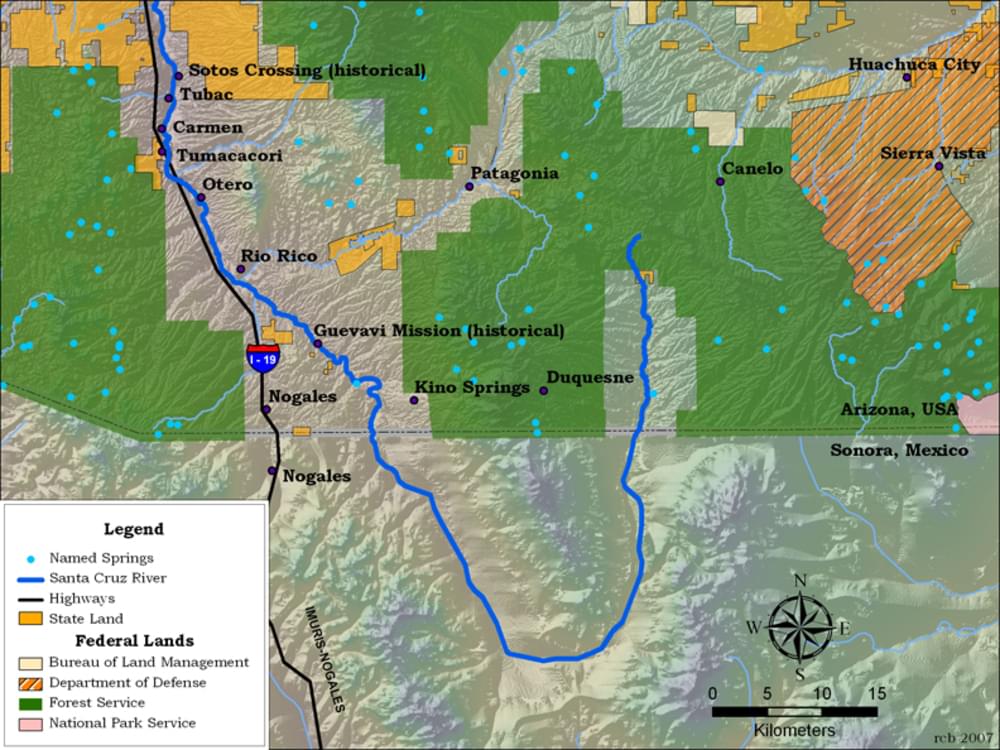
The Santa Cruz River is about 184 miles long. It begins in the high grasslands of the San Rafael Valley east of Patagonia. At first, it runs south into Sonora Mexico for several miles before it changes its mind and heads north back into Arizona where it passes the early Spanish missions of Tumacacori and San Xavier del Bac, and the old Spanish Presidio de Tucson about 70 miles north of the International Border.
Content from Official Website, Santa Cruz River Official Website, and Southeastern Arizona Bird Observatory webpage