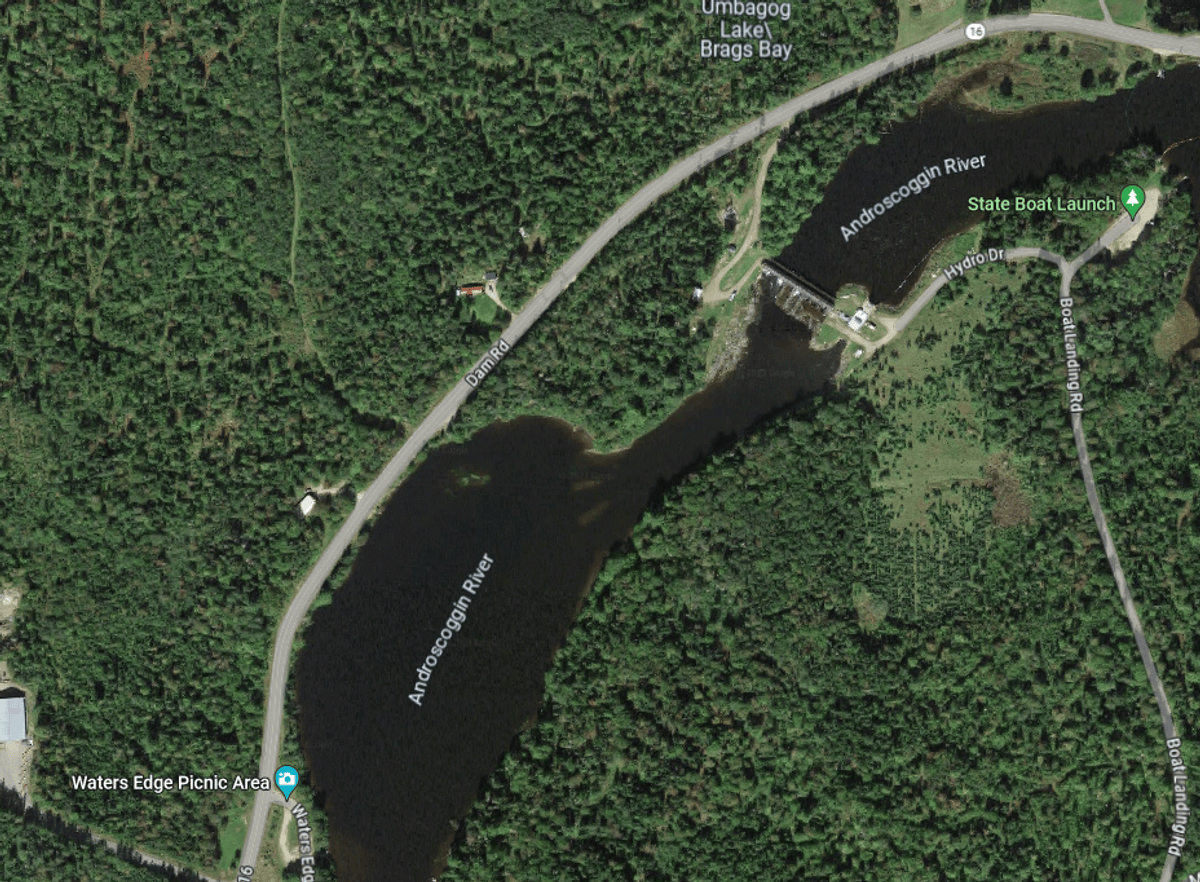
Androscoggin River at Errol Dam
About this Location
Errol Dam is a hydroelectric facility located on the Androscoggin River. It was built in 1853 to create Lake Umbagog, which covers parts of New Hampshire and Maine. The dam regulates the water level of the lake and the river and provides power to the surrounding area.
Dam Road (NH-16) parallels the rive in this area. There is a boat ramp above the Errol Dam and a picnic area down river from the dam.
About Androscoggin River
See all hotspots at Androscoggin River
The Androscoggin River is a river in Maine and New Hampshire. It is 178 miles long and joins the Kennebec River at Merrymeeting Bay in Maine before its water empties into the Gulf of Maine on the Atlantic Ocean. The river originates from Umbabog Lake in Coos County, New Hampshire, and flows through scenic landscapes, historic towns, and industrial areas.
The name "Androscoggin" comes from the Eastern Abenaki term meaning "river of cliff rock shelters" (literally "thus-deep-dwelling-river"); or perhaps from Penobscot meaning "river of rock shelters".
Features
Roadside viewing
Restrooms on site
Wheelchair accessible trail
Entrance fee
Last updated November 16, 2023
 From Google Maps