McDaniels Marsh WMA, Springfield
McDaniels Marsh WMA, Springfield
Springfield, New Hampshire 03284
Official WebsiteMcDaniels Marsh Wildlife Management Area map
About this Location
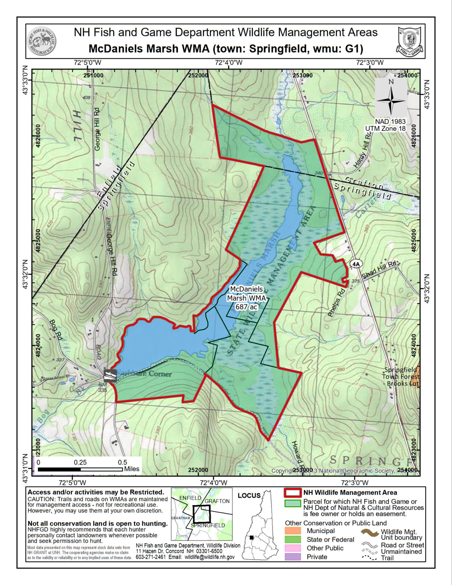
McDaniels WMA is located between Washburn Corner and NH-4-A in Springfield. From NH-4-A in Enfield, turn south onto Bog Road at George Pond. Follow the road for four miles to the junction of George Hill Road at Washburn Corner. The dam, marsh, parking lot, and a launch ramp will be on the left.
Three hundred acres consist of a diverse wetlands system located along Bog Brook. A water control structure built in 1958 maintains the conditions for quality waterfowl nesting and feeding habitat on the property. The wetland types on the property include bogs, forested wetlands, shrub/scrub wetlands, emergent vegetation, and deep-water wetlands. The uplands adjacent to the wetland systems are primarily forested and consist of spruce and fir.
There is a diversity of wildlife at McDaniels Marsh. Upland species include moose, white-tailed deer, black bear, mink, ruffed grouse, snowshoe hare, and woodcock. Nesting waterfowl include mallards, black ducks, wood ducks, hooded mergansers, and Canada geese. The migrant waterfowl at the marsh include blue- and green-winged teal, common goldeneyes, scaup, ring-necked ducks, and scoters. Look for belted kingfishers, yellow-rumped warblers, common yellowthroats, and song sparrows. The wetlands have warm-water fish, including bullheads, Eastern chain pickerel, and yellow perch.
Features
Roadside viewing
Restrooms on site
Wheelchair accessible trail
Entrance fee
Content from Official Website
Last updated October 27, 2023