Finger Rock Canyon
Finger Rock Canyon
Coronado National Forest Tucson, Arizona 85718
Official WebsiteFinger Rock Canyon map
Tips for Birding
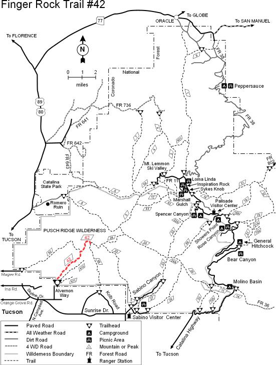
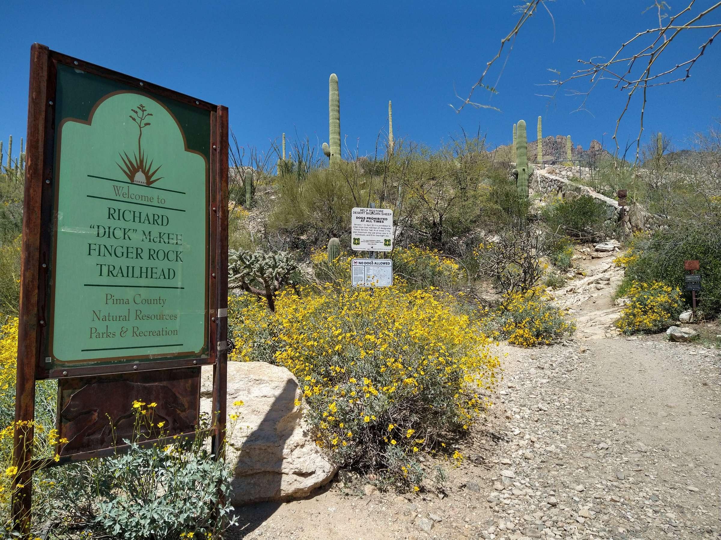
Finger Rock Trail gains 4100 feet over 5 miles to reach the summit of Mt. Kimball. Most hikers/birders turn around at Finger Rock Spring after 1.1 miles of rocky but well maintained gently rising trail. That's the route represented by this hotspot. You'll be walking amid lush Sonoran desert with many Saguaros and spectacular views. In rainy seasons the stream may be flowing. If you venture beyond the spring, the habitat will change with elevation so you should map checklists in personal locations. Readily discernable dividing points for the hike segments are between the spring and Linda Vista Saddle and between Linda Vista Saddle and Mt. Kimball. NOTE: dogs are not allowed in the trail at any time.
Birds of Interest
Typical desert birds plus Bell's Vireo and Varied Bunting in season. Scan the cliffs for swifts, raptors and swallows.
About this Location
As you look toward the Santa Catalinas from metropolitan Tucson, one of the most distinctive landmarks on the Pusch Ridge skyline resembles a closed hand with the index finger extended to make a #1 sign. This is Finger Rock, a 100-foot high formation that marks the steep canyon that bears its name.
Drive north from Tucson on Oracle Road (US-89) to Ina Road. Turn right (east) on Ina and drive about a mile to Skyline Road which branches off to the south (right). Follow Skyline (have to make a left to stay on Skyline) to Alvernon Way and turn left (north) to the trailhead and parking lot at the end of the pavement.
Notable Trails
Finger Rock Canyon offers one of the most direct routes into the Catalina Front Range with its spectacular views and precipitous formations. The trail starts easy and gets progressively rougher. Because of its graduated layout, hikers can tailor an outing along this trail to fit the amount of effort they want to expend. Or, they can “go for it” and continue past Mt. Kimball to Linda Vista Ridge and the head of Ventana Canyon. Many who come here choose Finger Rock Spring as a good turn-around point. A little looking around reveals some good picnic spots and outstanding overlooks. Beyond the spring, the trail steepens and becomes harder to follow. What has been rocky, rough going becomes even more so. Not surprisingly, as the going gets rougher the overlooks get better. Dramatic vistas of Finger Rock, the sheer walls of the canyon, Tucson, and the mountains beyond add to the lung-busting grades to give hikers plenty of incentive to stop, take a break, and look around. This hike starts in saguaros and climbs through the Upper Sonoran Zone into a habitat of yucca, live oak, juniper, and agave. The trail leads into the Pusch Ridge Desert Bighorn Sheep Management Area, so leave your dog at home. Finger Rock Trail ends at a junction where a set of switchbacks leads into Ventana Canyon toward Tucson and where Esperero Trail #25 leads to other trails that continue up the slopes of Mt. Lemmon.
Features
Restrooms on site
Wheelchair accessible trail
Entrance fee
Roadside viewing
Content from Official Website and Mark Stevenson
Last updated April 8, 2024