Pima Canyon Trailhead
Pima Canyon Trailhead
Coronado National Forest Tucson, Arizona 85718
Pima Canyon Official WebsitePima Canyon Trail map
About Pima Canyon
See all hotspots at Pima Canyon
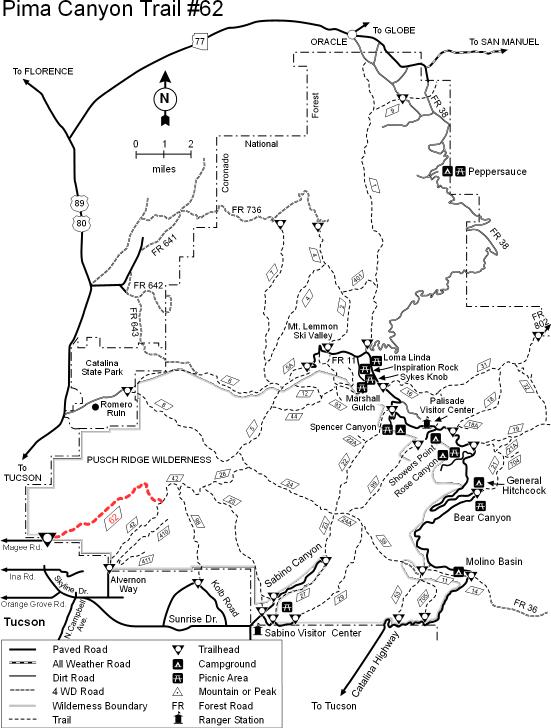
Though the stream in Pima Canyon is dry for most of the year, it supports an excellent example of a desert riparian habitat located conveniently close to the Tucson metropolitan area. Unfortunately, that accessibility has resulted in significant overuse of this beautiful and fragile area, especially during the winter, its season of highest use. From the trailhead, located among suburban ranches, the trail ascends a V-shaped notch carved along the south face of Pusch Ridge. Views down the canyon get better as you climb, encompassing the city of Tucson as well as distant mountains and valleys. The riparian area on the floor of the canyon provides excellent birdwatching for a wide variety of resident and migratory species that make use of this most productive of all desert habitat types. Other desert creatures you may encounter in this area include javelina and jackrabbits, but the real viewing prize of Pima Canyon and the entire Pusch Ridge area is the desert bighorn sheep that maintain a surefooted existence here among rocky crags and rugged canyons. Beyond Pima Spring, the trail becomes steeper and harder to follow as it continues to climb to the upper slopes of Mt. Kimball. Incentives for persevering here are good views of Window Rock and Cathedral Rock. Trail #62 ends at its junction with Finger Rock Trail #42.
Drive north from Tucson on Oracle Road (US-89). Turn east on Magee Road and drive to the parking area and trailhead at the road’s end.
Notable Trails
The AllTrails website has a description and map of a hike at Pima Canyon.
Content from Pima Canyon Official Website