Coonamessett Pond
About this Location
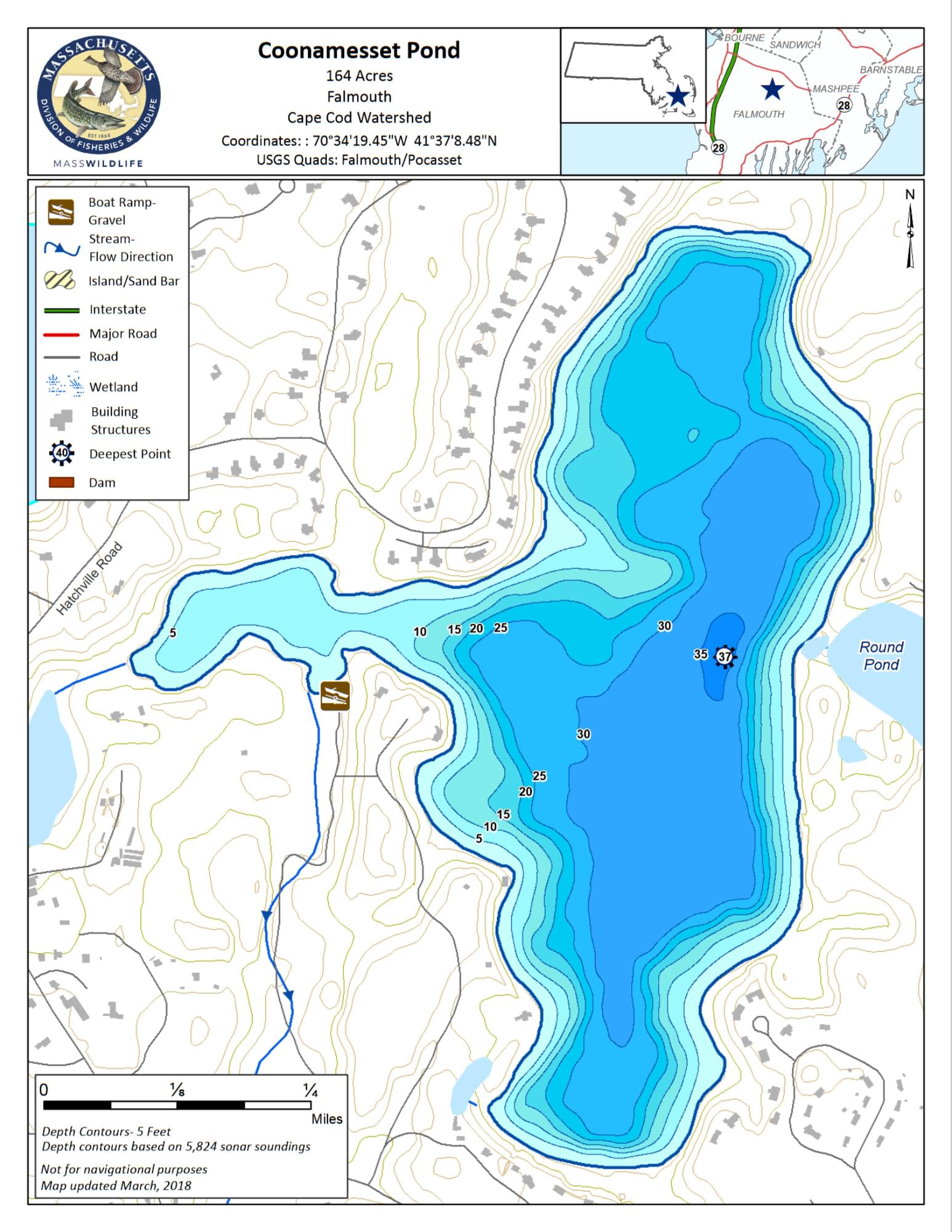
Coonamessett Pond is a 158-acre natural kettlehole pond with a maximum depth of 34 feet and an average depth of 19 feet. The pond is located in the Hatchville section of Falmouth. Transparency is only fair, extending to 6.5 feet. The pond stratifies during the summer but no trout water exists. The shoreline is 2.9 miles and is moderately developed with a golf course, cottages, and year-round homes. The pond receives water from groundwater and a small inlet from Round Pond and drains into the Coonamessett River.
Public access to Coonamessett Pond is provided by the town of Falmouth through the Souza Conservation Area on the southwestern end of the pond. It is located off Hatchville Road which runs between Sam Turner Road and Sandwich Road, both roads run south from Route 151. The access road is dirt and narrow and rutted, the unimproved ramp is suitable only for cartop boats and canoes. Parking is available for approximately five cars.
Features
Restrooms on site
Wheelchair accessible trail
Entrance fee
Content from Coonamessett Pond map
Last updated March 5, 2024