Annursnac Conservation Land
Annursnac Conservation Land
Concord, Massachusetts 01742
Annursnac Conservation Land information and mapAbout this Location
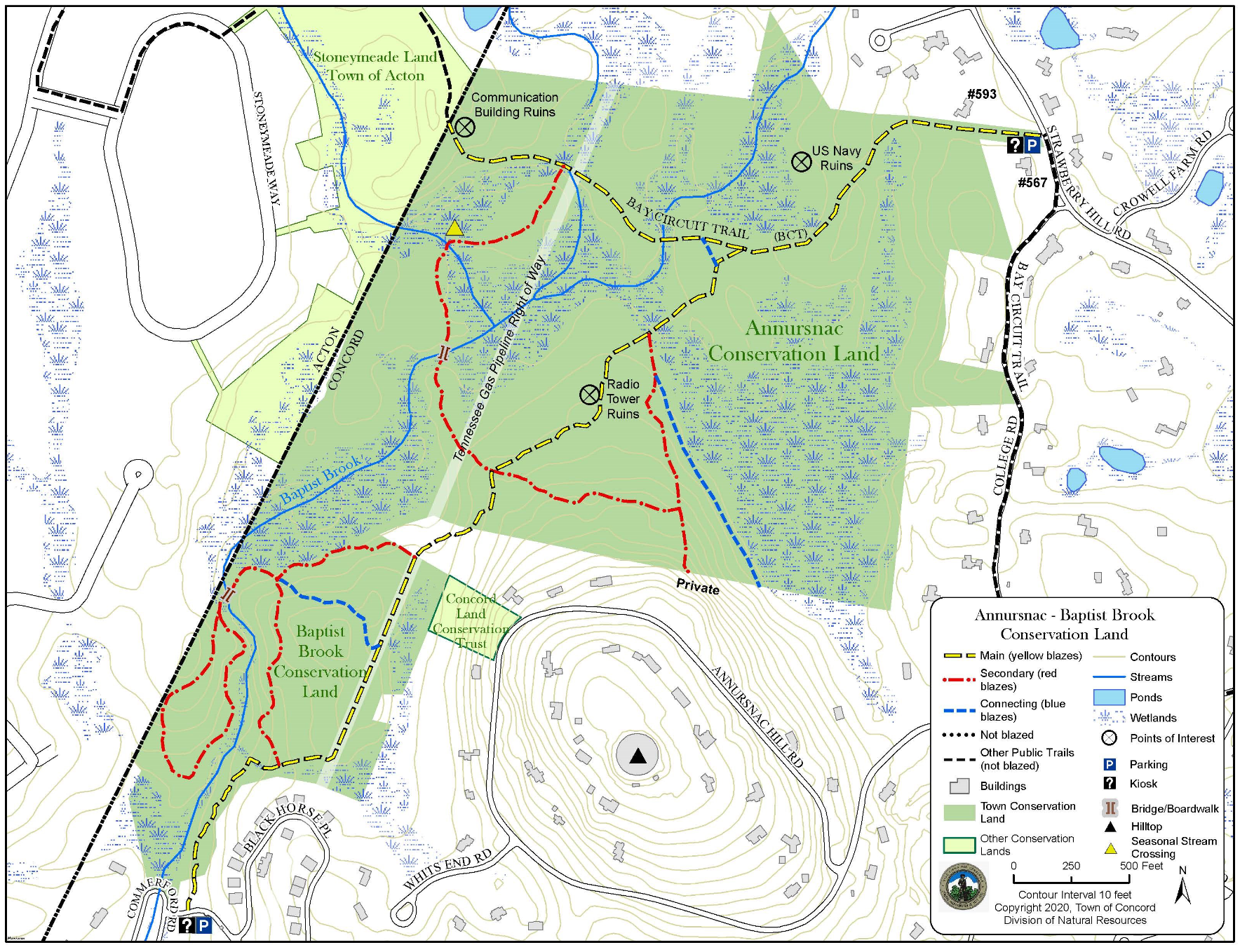
The conservation land consists of two areas connected by an easement through a short section of private property. The Annursnac section lies between Annursnac Hill to the south and Strawberry Hill to the north, a 118-acre property purchased by the Town of Concord from Harvard University in 1970. The area supported the Native American taste for wild strawberries because the Algonquin name Annursnac has been interpreted to mean “place to pick strawberries”. A possibly more likely meaning associated with the 365-foot-high Annursnac Hill is “secure hill”. The varied terrain of woodlands, meadows, and wetlands is intersected by Baptist Brook and the Tennessee Gas Pipeline right of way.
Access with limited vehicle parking is located off of Strawberry Hill Road a short distance from the junction with College Road where a large sign “Annursnac Conservation Area” identifies the entrance. A second access is at the entrance to Black Horse Place off of Commerford Road. The trailhead is across the entrance road from a small public parking lot.
The Annursnac land, 118 acres in all, has hilly woodlands and swampy lowlands. Fine stands of white pine grow on the higher land with red maple, birch, and marshy vegetation in the wet areas. Trails that climb the side of Annursnac Hill reach heights 80 feet above the low areas.
Notable Trails
The AllTrails website has a description and map of a hike at Annursnac Conservation Land.
Features
Restrooms on site
Wheelchair accessible trail
Entrance fee
Content from Annursnac Conservation Land information and map
Last updated December 20, 2023