Farrar Pond, Lincoln
About this Location
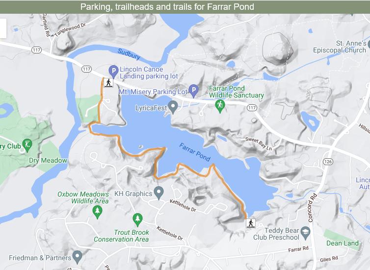
Farrar Pond covers 88 acres and was created in the early 1900s by Edward R. Farrar, who flooded a low-lying hay field called Oaky Bottom. The pond is privately owned and not open for public fishing or boating, but there is a wooded trail along the southern shoreline that offers beautiful views of the water and wildlife. The trail is about 3.2 miles long and moderately challenging, and it can be accessed from Canoe Landing on MA-117.
Notable Trails
The AllTrails website has a description and map of a hike at Farrar Pond.
Features
Restrooms on site
Wheelchair accessible trail
Entrance fee
Content from Farrar Pond webpage and map
Last updated December 24, 2023