Tophet Swamp
Tophet Swamp
Lexington, Massachusetts 02420
Tophet Swamp information and mapMinuteman Commuter Bikeway webpage
About this Location
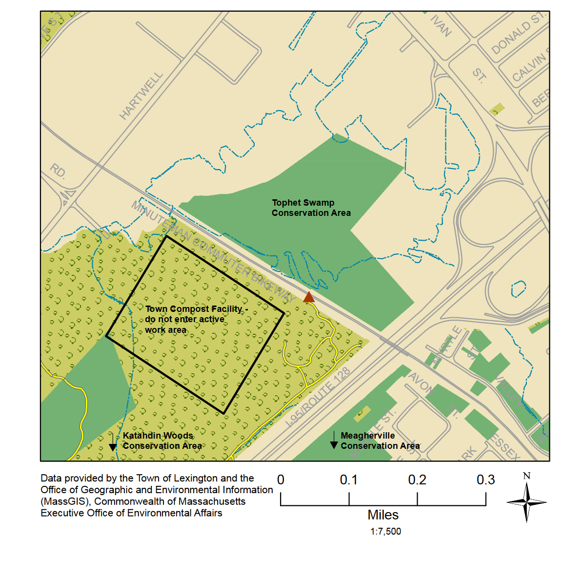
Tophet Swamp is 28 acres with a connecting trail to the Katahdin Woods conservation area. Tophet Swamp conservation area contains part of Tophet Swamp, the lowest point in Lexington at 110 feet above sea level. Although there are no trails in Tophet Swamp, the Minuteman Commuter Bikeway passes through the area and provides scenic viewing opportunities. Many birds, including hunting raptors, frequently visit Tophet Swamp, and the summer finds it teeming with red-winged blackbirds. A trail on the southern side of the bikeway leads into the Katahdin Woods conservation area.
Access is from the Minuteman Commuter Bikeway between Hartwell Avenue and the I-95 overpass.
Features
Wheelchair accessible trail
Restrooms on site
Entrance fee
Content from Tophet Swamp information and map
Last updated January 9, 2024