Four Corners Town Hayfields Conservation Area
About this Location
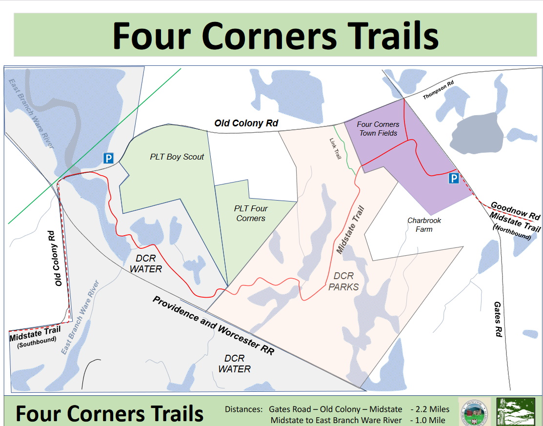
The trailhead for the Four Corners Trail is just south of the four-corner intersection between Gate, Old Colony, and Thompson Road. There is a small parking area and kiosk for the Midstate Trail. The trail is 2.5 miles, an easy walk.
The trail goes from the Midstate Kiosk on Gates Road, up Gates Road to Old Colony, and left on Old Colony Road down to the bridge over the West Branch of the Ware River. The bridge is at a lovely spot over the West Branch of the Ware River, with an extensive wetland to the north and a smaller pond to the south. At this point, the Midstate trail continues over the bridge with nice walks over to Savage Hill Wildlife Management Area.
The Four Corners Conservation Area was preserved a few years ago by a project initiated by neighbors and supported by the Princeton Land Trust and Mass Audubon. As a result of that effort, the area is great for hiking!
Highlights are the bridge and marsh around the West Branch of the river, and the views when returning to the Four Corners fields.
Notable Trails
The AllTrails website has a description and map of a hike at Four Corners Town Hayfields Conservation Area.
Features
Restrooms on site
Wheelchair accessible trail
Entrance fee
Content from Official Website
Last updated December 11, 2023