Quaboag Pond
About this Location
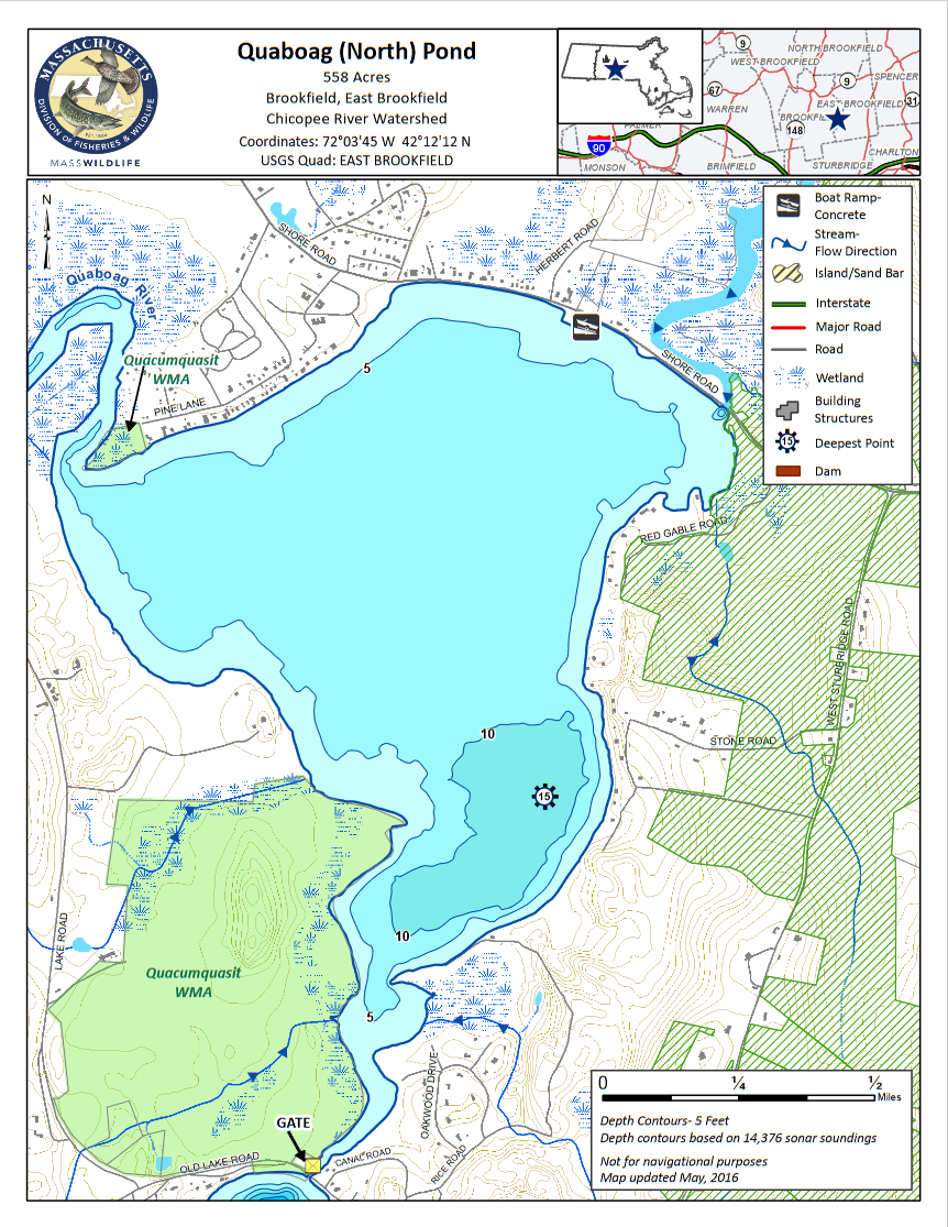
Quaboag Pond is a 558-acre Great Pond located approximately 2 miles southeast of Brookfield Center on the Brookfield-East Brookfield town line. Quaboag Pond has an average depth of 6 feet, and a maximum of 16 feet, and aquatic vegetation is relatively common within areas less than 10 feet deep. The majority of shoreline development occurs on the northern and eastern shores. The Quacumquasit Wildlife Management Area is located on the southwestern shore and is undeveloped. Quaboag Pond is fed by the East Brookfield River and the Quaboag River, the latter of which is navigable to boaters for some distance through the Quaboag Wildlife Management Area up to the Davis Road crossing (not shown on the map). Quaboag Pond is a popular destination for recreational boaters, swimmers, and paddlers during the summer months.
The town of Brookfield manages a large concrete boat ramp and adjacent parking area suitable for 30 trailers on the north shore of the pond off Shore Road. Shoreline access is available along Shore Road on the north end, and from the Quacumquasit Wildlife Management Area on the southwestern shore.
Features
Roadside viewing
Restrooms on site
Wheelchair accessible trail
Entrance fee
Content from Quaboag Pond guide and map
Last updated December 17, 2023