Morrill Pond WMA, Canterbury
About this Location
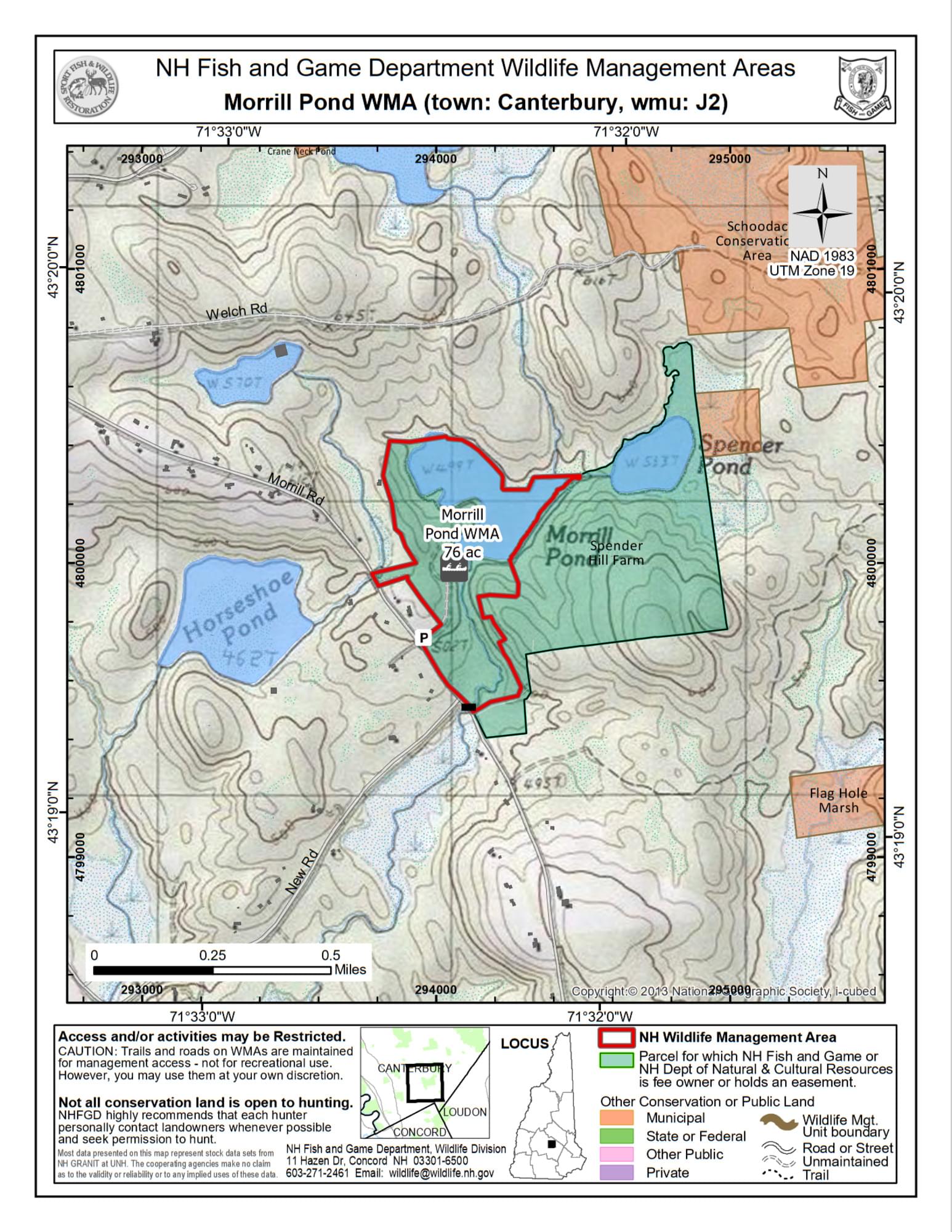
The Morrill Pond Wildlife Management Area(WMA) was purchased by the New Hampshire Fish and Game Department in 1993 using state and federal funds in addition to a contribution by the former landowners.
The forestland is of mixed species and age including red, black, and white oaks, red maple, beech, scattered white pine, and pockets of hemlock. This property includes the 29.3-acre Morrill Pond, an impoundment held with an earthen/stone dam that maintains the water level. A significant portion of the pond is a wet meadow dominated by grasses, sedges, and shrubs. The remainder of the pond is open, shallow, and edged with emergent vegetation. A depth map can be found here. Morrill Pond empties through Hayward Brook which flows south past red maple and alder wetlands.
This property provides quality waterfowl habitats. Common waterfowl species include wood ducks, black ducks, mallards, and hooded and common mergansers. Morrill Pond is a typical warm water fishery with largemouth bass, eastern chain pickerel, and hornpout. Other common wildlife species include white-tailed deer and beaver.
Access is provided off Tallant Road with a well-maintained woods road accessing the dam site. Canoe/car top access and parking facilities can be accessed from NH-132 to New Road to Morrill Road.
Features
Restrooms on site
Wheelchair accessible trail
Entrance fee
Last updated October 31, 2023