Sunapee-Ragged-Kearsarge (SRK) Greenway Trail--#10 Proctor Academy to Winslow SP
Sunapee-Ragged-Kearsarge (SRK) Greenway Trail--#10 Proctor Academy to Winslow SP
Sunapee-Ragged-Kearsarge Greenway Wilmot, New Hampshire 03287
Sunapee-Ragged-Kearsarge Greenway Trail #10 mapSunapee-Ragged-Kearsarge Greenway website
Sunapee-Ragged-Kearsarge Greenway maps
About this Location
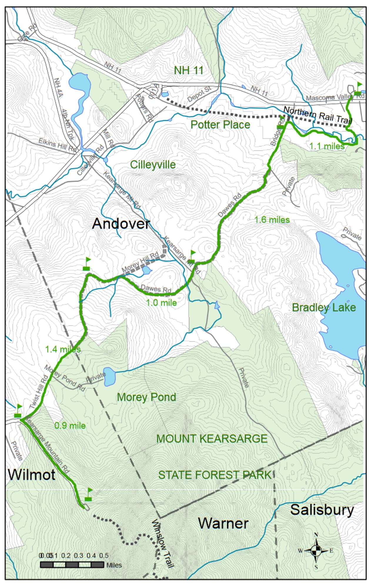
This section of the SRKG leaves Proctor Academy in Andover (incorporated 1779) and climbs gradually from the Blackwater River Valley to Winslow State Park in Wilmot on the northwest shoulder of Mount Kearsarge. Using several unmaintained roads, it passes through abandoned settlement areas. The section from Morey Pond to Bridge Road is a popular snowmobile and cross-country ski trail. With state and federal trails and transportation funding, the Andover to Danbury section of the 1847 Northern Railway is being rebuilt as a recreation trail by the Friends of the Northern Rail Trail in Merrimack County.
The northern trailhead is at Farrell Field House at Proctor Academy, in the center of Andover on routes NH-11 and US-4. The Farrell Field House is the large red brick building directly across the road from the white-fenced playing fields, just west of the town center. Parking is both in front of and behind the field house. The southern trailhead is in Winslow State Park in Wilmot. The park is reached via Kearsarge Valley Road, which leaves NH-11 in Wilmot Flat, 4.5 miles west of Proctor Academy’s Farrell Field House, or 3.8 miles east of the intersection of NH-11 and NH-114 in New London. The park is also accessed from I-89, Exit 10, in Sutton; follow the signs to North Road, Kearsarge Valley Road, and then Kearsarge Mountain Road; where it’s 2.2 uphill miles to the gate. Parking at Winslow requires a fee or park pass during peak seasons. Winter parking is permitted at the park gate or snowplow turnaround.
About Sunapee-Ragged-Kearsarge (SRK) Greenway Trail
See all hotspots at Sunapee-Ragged-Kearsarge (SRK) Greenway Trail
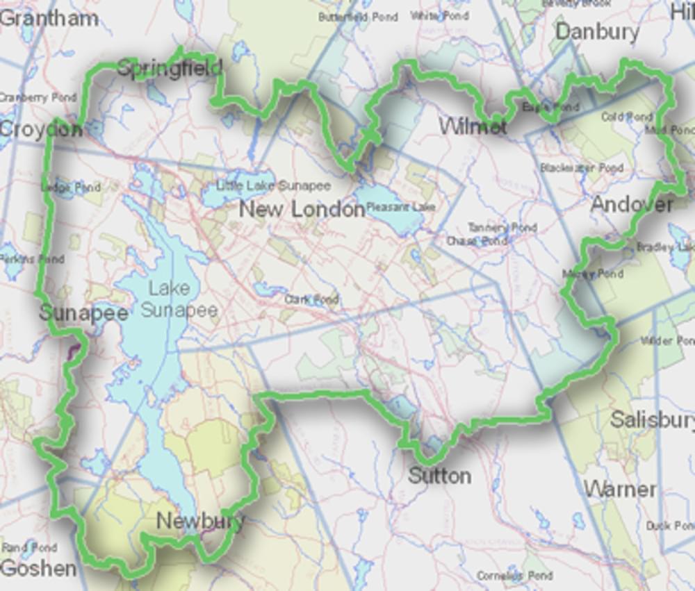
The Sunapee-Ragged-Kearsarge (SRK) Greenway Trail is a 75-mile loop of hiking trails in central New Hampshire. The Greenway Trail System circles the Lake Sunapee area and connects Sunapee, Ragged, and Kearsarge Mountains.
The Greenway’s mission is to create and maintain a forever green, great circle of trail corridors and conserved lands providing walkers with minimally-developed access to the mountains, lakes, vistas, and historical sites of the Lake Sunapee Region.
Notable Trails
Total Distance: 6.0 miles Estimated time: 3.5 hours Ascents: total 1300 feet Descents: total 140 feet
Features
Restrooms on site
Wheelchair accessible trail
Entrance fee
Content from Sunapee-Ragged-Kearsarge Greenway website
Last updated November 3, 2023