Guadalupe Canyon (Hidalgo Co.)
Guadalupe Canyon (Hidalgo Co.)
Important Bird Area Animas, New Mexico 88020
Guadalupe Canyon IBAGuadalupe Canyon Wilderness Study Area webpage
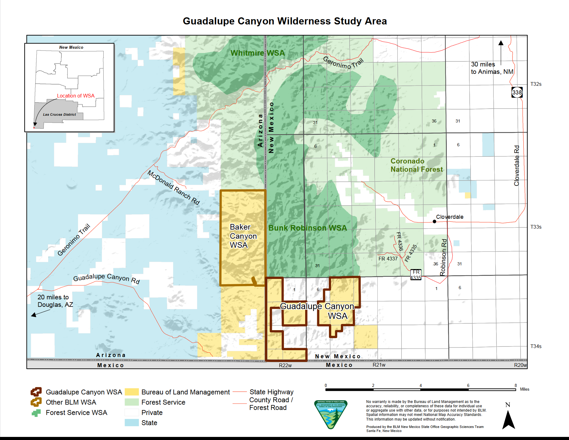
Guadalupe Canyon Wilderness Study Area map
About this Location
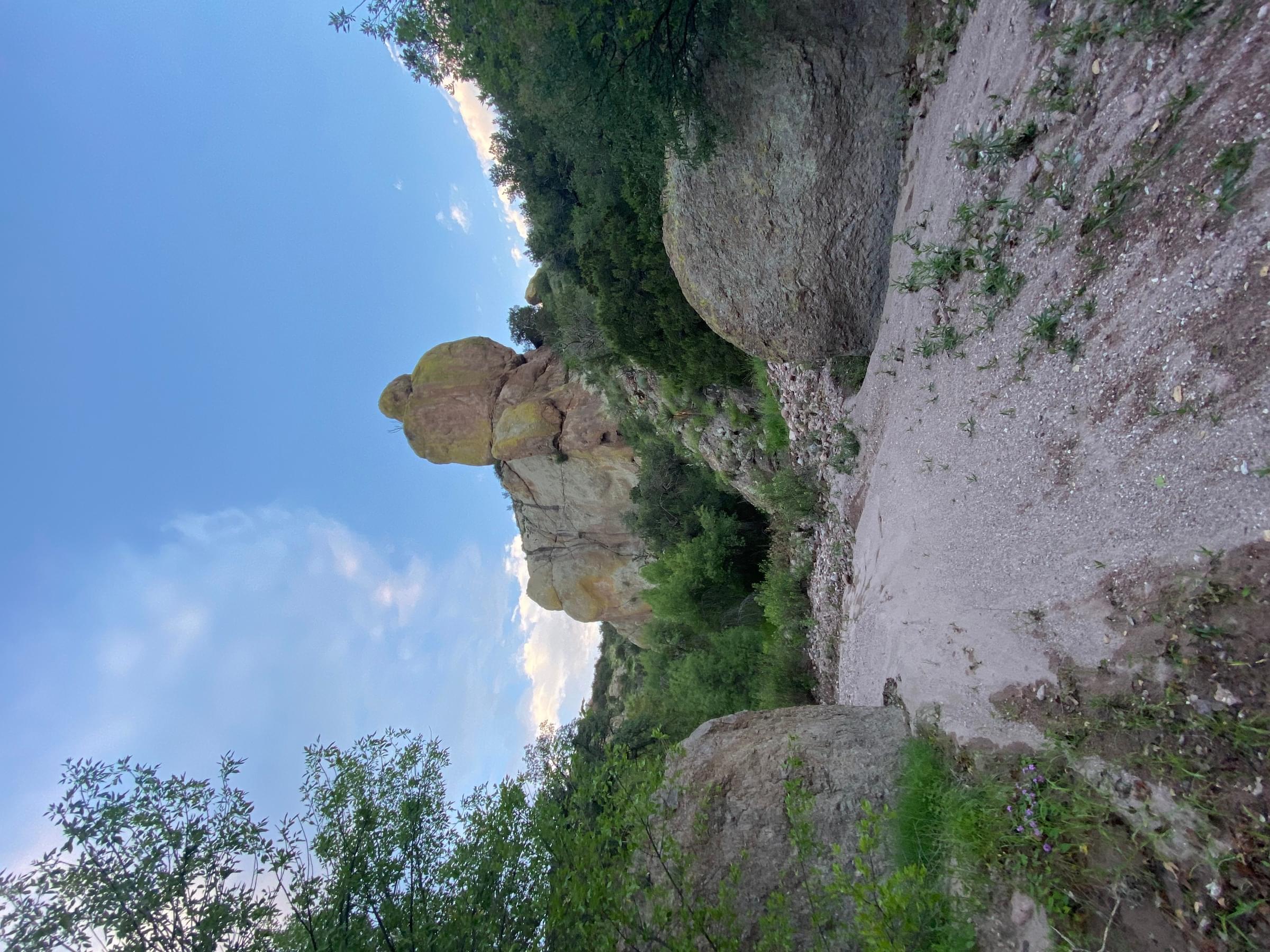
Guadalupe Canyon is located in the southern Peloncillo Mountains in the far southwest corner of the state along the Arizona and Mexico borders. The canyon is 1.5 miles north of the Mexico border and 2 miles east of the New Mexico/Arizona state line. You reach it from Douglas Arizona or Clanton Canyon. The canyon never reaches over 600 feet deep and lies along the southern border of Coronado National Forest. The BLM declared it an outstanding natural area for its birding habitat. You may camp on BLM or national forest lands. The canyon’s streams flow intermittently during late summer after thunderstorms, but there are no reliable water sources. The riparian habitat includes Arizona Sycamore, Freemont Cottonwood, oak, and willow surrounded by desert habitats containing juniper, agave, yucca, cholla, prickly pear, and grasses. Since this area lies along the Mexico-United States Border, do not be surprised to see Border Patrol or smugglers.
Most people go to Guadalupe Canyon for birding. Many species seen here are rarely seen in the U.S. as the canyon is the northeastern edge of their range. Species include the Costa’s, Broad-billed, Blue-throated, Magnificent, and Violet-crowned Hummingbird, Northern Beardless-Tyrannulet, Thick-billed Kingbird, and Varied Bunting. Other species of interest and localized to southwest New Mexico and southeast Arizona are Elf Owl, Gila Woodpecker, Dusky-capped and Brown-crested Flycatcher, Mexican Jay, Bridled Titmouse, Verdin, Phainopepla, Lucy’s Warbler, and Hooded Oriole. Spring and fall are the best times in the canyon for birding. Heat in summer and cold in winter keep bird activity low.
Directions: From the summit at Clanton Canyon continue on FR-63 for slightly over 15 miles to the junction with the Guadalupe Canyon turnoff (well marked). Continue east for 9 miles on the Guadalupe Canyon road.
Notable Trails
The AllTrails website has a description and map of a hike at Guadalupe Canyon.
Content from Guadalupe Canyon IBA