Rio Grande del Norte NM--Sheep Crossing Overlook
Rio Grande del Norte NM--Sheep Crossing Overlook
Questa, New Mexico 87556
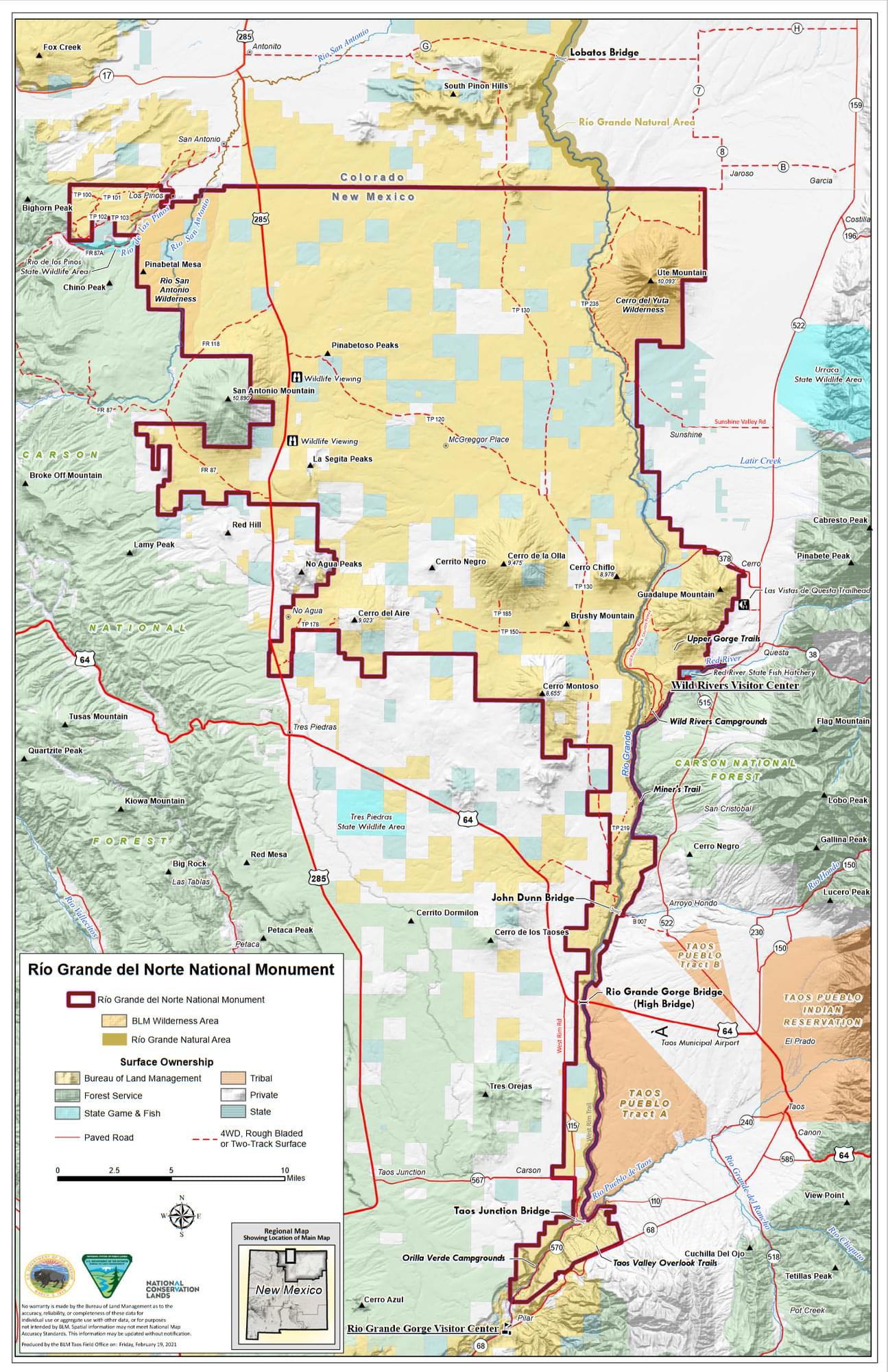
Rio Grande del Norte National Monument Official WebsiteRio Grande del Norte National Monument map
About this Location
The Sheep Crossing Overlook is on the Wild Rivers Backcountry Byway (NH-378).
About Rio Grande del Norte National Monument
See all hotspots at Rio Grande del Norte National Monument
The Rio Grande del Norte National Monument is comprised of rugged, wide open plains at an average elevation of 7,000 feet, dotted by volcanic cones, and cut by steep canyons with rivers tucked away in their depths. The RÍo Grande carves an 800-foot deep gorge through layers of volcanic basalt flows and ash. Among the volcanic cones in the Monument, Ute Mountain is the highest, reaching to 10,093 feet.
This area has attracted human activity since prehistoric times. Evidence of ancient use is found throughout the area in the form of petroglyphs, prehistoric dwelling sites, and many other types of archaeological sites. More recent activity includes abandoned homesteading from the 1930s.
The Monument is an important area for wintering animals and provides a corridor by which wildlife moves between the two mountain ranges.
The unique setting of the Monument also provides a wealth of recreational opportunities. Whitewater rafting, hunting, fishing, hiking, mountain biking, and camping are some of the more outstanding activities that can be enjoyed in the Monument.
Content from Rio Grande del Norte National Monument Official Website