Blackstone River Bikeway
Blackstone River Bikeway
Lincoln, Rhode Island 02865
Blackstone River Bikeway Official WebsiteBlackstone River Bikeway map
About Blackstone River Bikeway
See all hotspots at Blackstone River Bikeway
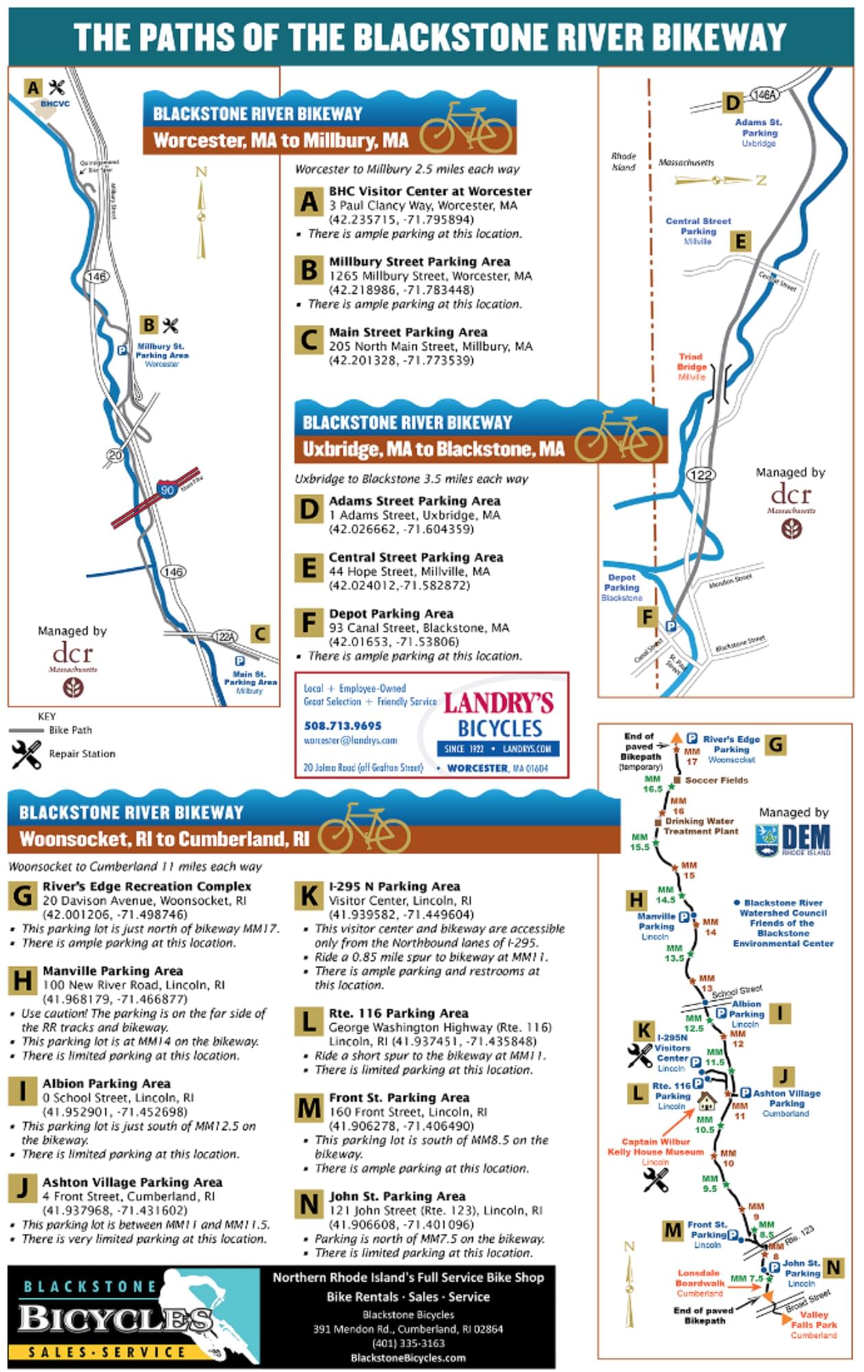
The Blackstone River Bikeway is the state's second-longest bike path, with 18.2 miles of bikeway - which includes 11.6 miles of path between Cumberland and Woonsocket and segments of on and off-road bikeway heading south to India Point Park in Providence and north to the Massachusetts border.
While the path ends in Cumberland, experienced riders can find their way to Providence and the start of the East Bay Bike Path through a series of on-road markers called “sharrows.”
The path follows the Blackstone River wherever possible, including on the tow paths of the historic Blackstone Canal. This highly scenic bikeway crosses the river many times, offering views of waterfalls, marshes, and wildlife. Many old mills line the river too, evidence of the impact of the Industrial Revolution that earned the Blackstone the title of the “hardest-working river in America.”
Parking areas along the bikeway are available at these locations:
- Blackstone River State Park, Front Street, Lincoln
- Former Lonsdale Drive-In Parking, John Street, Lincoln
- I-295 Visitor Center parking, Lincoln
- Kelley House, Lower River Road, Lincoln
- River’s Edge Park at Davison Avenue, Woonsocket
- River Road, Manville, Lincoln
- Route 116 parking area (George Washington Highway), Lincoln
- School Street, Albion Village, Lincoln
- Weber Street, Cumberland
Notable Trails
The AllTrails website has a description and map of the Blackstone River Bikeway.
Content from Blackstone River Bikeway Official Website