Allis State Park
Allis State Park
284 Allis State Park Road Randolph, Vermont 05060
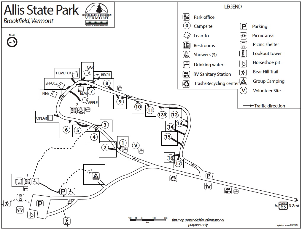
Official WebsiteAllis State Park map
About this Location
Allis State Park was established in 1928 as Vermont’s second-developed state park. The park is named for Wallace Allis, who willed his Bear Mountain Farm to the State of Vermont to be developed as a campground and recreational area. It is located on the summit of Bear Hill which provides sweeping views of central Vermont from a lookout tower once used to spot forest fires. On a clear day, Killington, Pico, and Mt Ascutney peaks are visible to the south; Camels Hump and Mount Mansfield to the north; Abraham, Lincoln, and Ellen to the west; the White Mountains of New Hampshire to the east. The fire tower has an information panel explaining the view.
The property was in the Allis family for several generations as a working farm. The entire hill was open pasture land with excellent views from just about any spot. Mr. Allis allowed the public to enjoy the views from the hill; its popularity led him to leave it to the State. Today, all that remains as evidence of the farm are many stone walls that crisscross the property.
The park was developed by the Civilian Conservation Corps (CCC) beginning in 1932. They built up the access roads and constructed a massive timber picnic shelter, picnic grounds, and a campground. The park has undergone several improvements and changes in operations since that time.
Notable Trails
The TrailFinder website has a description and map of a hike at Allis State Park.
Features
Restrooms on site
Entrance fee
Wheelchair accessible trail
Content from Official Website
Last updated October 9, 2023