Sherburne Pass
Tips for Birding
Birdwatching in Vermont, p. 76.
About this Location
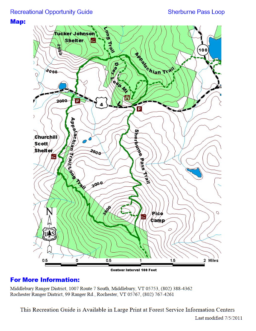
From the Appalachian Trail/Long Trail parking lot on US-4 in Mendon, follow the AT/LT south. The trail crosses a bridge and bears left then climbs gradually to the Churchill Scott Shelter at 1.9 miles. The shelter is located on a spur trail 0.1 miles from the AT/LT. Continue on the AT/LT south, and you will continue to climb gradually to the intersection with the Sherburne Pass Trail at 3.8 miles. At this junction, the AT/LT continues to the right in a southerly direction to Cooper Lodge and Killington Peak, on its way to Georgia. To continue the Loop, turn left here onto the Sherburne Pass Trail. You will soon pass Pico Camp, at 4.3 miles, and the Pico Link Trail, a 0.4-mile spur trail to the summit of Pico Peak. Follow the Sherburne Pass Trail as it descends to US-4 at 6.8 miles. Use extreme caution crossing US-4: it is a busy highway. Sherburne Pass Trail continues on the north side of US-4. Follow it as it climbs gradually through a rocky talus area and open hardwoods to the Appalachian Trail junction at 7.3 miles. The AT North continues to the right in an easterly direction to Gifford Woods State Park (1 mile), on its way to New Hampshire and Maine. Continue the Loop by following the Appalachian Trail South (which travels northerly for a short stretch). You will soon pass the southern (7.4 miles) and the northern (8.1 miles) Deer Leap Trail junctions, and come to the Long Trail Junction (Maine Junction) at 8.2 miles. The Long Trail continues to the north to Tucker Johnson Shelter (0.4 miles) and Canada. To continue the Loop, take a left and follow the AT/LT south back to the AT/LT parking lot on US-4 at 12.2 miles.
Features
Restrooms on site
Wheelchair accessible trail
Entrance fee
Content from Official Website
Last updated October 7, 2023